Published Jun 08, 2023 | 3:48 PM ⚊ Updated Jun 08, 2023 | 3:56 PM

")
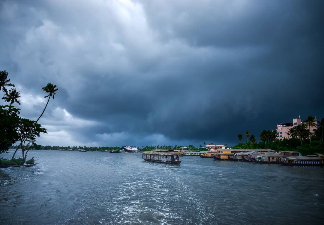
Clouds over the Arabian Sea and the Bay of Bengal as of 8 June. (IMD)

The wait is over. The India Meteorological Department (IMD) declared the much-anticipated onset of the Southwest Monsoon over Kerala.
“The Southwest Monsoon has set in over Kerala on Thursday, 8 June, against the normal date of 1 June,” the Meteorological Centre Thiruvananthapuram said.
“Southwest Monsoon has advanced into remaining parts of south Arabian Sea and some parts of central Arabian Sea, entire Lakshadweep area, most parts of Kerala, most parts of south Tamil Nadu, remaining parts of Comorin area, Gulf of Mannar and some more parts of southwest, central and northeast Bay of Bengal today,” IMD stated on Thursday early afternoon.

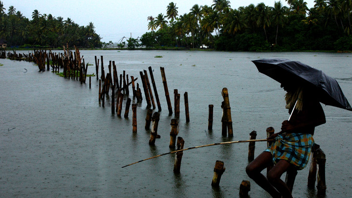
Monsoon time. People crossing a river by boat in rain with umbrellas. (iStock)
Meanwhile, there has been widespread rainfall over Kerala in the past 24 hours.
“Conditions are favourable for further advance of Southwest Monsoon into some more parts of central Arabian Sea, remaining parts of Kerala, some more parts of Tamil Nadu, some parts of Karnataka and some more parts of southwest, central and northeast Bay of Bengal, and some parts of north-eastern states during next 48 hours.”
“It may progress northwards after a couple of days. But overall progress seems to be slow,” said Madhavan Nair Rajeevan, Ministry of Earth Sciences distinguished scientist at the National Centre for Earth Science Studies (NCESS), Thiruvananthapuram, a famous monsoon expert.
“It is early to predict extreme events in Kerala. But they should be prepared for such cases like any other year,” he told South First.
Southwest Monsoon has set in over Kerala today, the 08th June, 2023.
for more information: https://t.co/RlDbY8HDua#India #IMD #heatwave #weather #WeatherUpdate, @DDNewslive, , @ndmaindia, @airnewsalerts, @moesgoi pic.twitter.com/buYog1vHFS— India Meteorological Department (@Indiametdept) June 8, 2023
The Kerala State Disaster Management Authority (KSDMA) has acknowledged that there is a likelihood of extreme rain events, adding that the state is fully prepared.
Monsoon clouds in Alappuzha. (abijith_soman/Instagram)
Chief Minister Pinarayi Vijayan approved the Yellow Book outlining monsoon anticipatory action, preparedness, and guidelines with the involvement of central forces and 36 agencies on 30 May. This is the fifth edition since the flood year of 2019.
Monsoon preparedness started on 1 April and the response capacity was augmented by 10,000 Civil Defence volunteers, 4,500 Aapta Mitra and 2,100 Team Kerala personnel, said Sekhar Lukose Kuriakose, Member Secretary, Kerala State Disaster Management Authority and head of the State Emergency Operations Centre.
“These volunteers are aligned to 129 fire stations in the state,” Kuriakose told South First.
The places where there could be rain impacts include Alappuzha, Wayanad, Pathanamthitta, Thrissur and Malappuram, SDMA scientists said, based on the past record.
The monsoon onset was delayed this time due to the impact of cyclones, scientists said.
Typhoon Mawar over the Pacific and later Cyclone Biparjoy contributed to the delayed onset and progress of monsoon by affecting cloud movement and wind flow.
Biparjoy, however, brought rainfall over Kerala.
The very severe cyclone Biparjoy over the East-central Arabian Sea is slowly moving northward and was located about 850 km west-southwest of Goa, IMD regional centre that tracks cyclones in Chennai said on Thursday.
The IMD forecast is that it will intensify further gradually in 24 hours and move north-northwestwards in the next three days.
VSCS BIPARJOY over eastcentral Arabian Sea at 1130 IST of today, near lat 14.1N and long 66.0E, about 850 km west-southwest of Goa, 900 km southwest of Mumbai, 930 km south-southwest of Porbandar and 1210 km south of Karachi. To intensify further during next 3 days. pic.twitter.com/bzeq7g7TDF
— India Meteorological Department (@Indiametdept) June 8, 2023
IMD said that the prerequisites for the onset of monsoon to be officially declared were met over the past 24 hours.
IMD scientists noted that, after 10 May, if eight of the 14 listed stations report rainfall of 2.5 mm or more for two consecutive days, the onset over Kerala can be declared on the second day, provided some wind, and reflected radiation conditions are also met.
The stations involved are Minicoy and Amini in the Lakshadweep Islands, Thiruvananthapuram, Punalur, Kollam, Alappuzha, Kottayam, Kochi, Thrissur, Kozhikode, Thalassery, Kannur, and Kudulu in Kerala, and Mangaluru in Karnataka.
The other IMD criteria include the depth of westerlies maintained up to a certain low level of pressure (600 hPa) in the area between the equator to Latitude 10 degree North and Longitude 55-degree East to 80-degree East.
Monsoon rain in Kerala. (Kerala Tourism)
The atmosphere exerts pressure on the Earth’s surface, measured in hectoPascals (hPa), also called millibars.
Standard pressure at sea level is defined as 1013 hPa, but it can vary. The zonal wind speed over the area bounded by Latitude 5-10 degree North and Longitude 70–80-degree East should be 15 – 20 Knots (28 to 37 kmph) at 925 hPa pressure.
Outgoing longwave radiation, a measure of the amount of energy (received from the sun) emitted back to space by earth’s surface, oceans, and atmosphere, should be below 200 Watts per metre squared in the area inside Latitude 5 – 10 degrees North and 70–75-degree East. It measures the amount of cloud cover and water vapour that intercepts the radiation in the atmosphere.
During the past 24 hours, cloud cover has increased over the Southeast Arabian Sea with Outgoing Longwave Radiation less than 200 watts per square metre, IMD scientists said.
“The depth of westerly winds over Southeast Arabian Sea extends upto middle tropospheric levels. The strength of Westerly winds in the lower levels has increased and is about 19 knots (35kmph).”
The Northern Limit of Monsoon (NLM) now passes through Kannur in Kerala, Kodaikanal and Adirampattinam, in Tamil Nadu, according to IMD figures.
