Published Jan 15, 2024 | 9:00 AM ⚊ Updated Jan 15, 2024 | 9:00 AM


High waves of the monsoon season hurl up a rope-tied shore-seine boat at Thumba, Thiruvananthapuram. (Stills from the upcoming documentary Crashing Waves by Vincy Lopez )

Severe cyclone Michaung left a trail of heavy rains and destruction in Chennai, Thoothukudi, and elsewhere, marking the end of the 2023 North Indian Ocean (NIO) storm season and highlighting the need for impact-based forecasting amidst a trend of strengthening cyclones.
The NIO, comprising the Arabian Sea and the Bay of Bengal, is becoming stormier. The Indian Ocean is the warmest ocean basin, and the Arabian Sea is warming rapidly. And the lives and livelihoods of people on the NIO rim are at risk.
India has efficient early warning and evacuation services that save lives. Storms still impact livelihoods, assets, and infrastructure due to the extensive wind, wave, and surge damage they cause.
Often, we do not get to know precisely what they would bring locally on coasts on or off their tracks — like record-breaking rains, floods, or just no effect. Which is why experts have called for probabilistic forecasts in the aftermath of the Michaung floods.
As Dr Mrutyunjay Mohapatra, Director General of Meteorology, India Meteorological Department (IMD), noted while publishing a recent storm study he coauthored: “The report urges development strategies that account for the dangers posed by a changing climate and weather as well as policy and technological initiatives in the areas of storm warning, impact-based local weather services, and localised reliable weather services.”
That roughly means forecasts should tell us not only what storms at different distances will be like, but also what they will do to our neighbourhoods or fishing grounds so that we can do something about them.

Rocky shorelines protect part of the tourist hub Kovalam in Thiruvananthapuram from waves and surges. (Stills from the upcoming documentary Crashing Waves by Vincy Lopez)
The NIO is not as stormy as other oceans. The average annual frequency of storms here is about five out of the global figure of 85, with the Arabian Sea usually spawning one to two. The North Atlantic Ocean, on the other hand, records an annual average of 14 storms.
March-June and October-November comprise the NIO storm season. Monsoon months (June to September) produce many low-pressure systems, but they usually do not strengthen into cyclonic storms (wind speed of 62-88 kmph). Still, they affect fishing and shore-based activities.
During the season, there may be severe (89–117 kmph), very severe (118-166 kmph), extremely severe (167-221), or super (above 222 kmph) cyclonic storms. The 2023 season saw three extremely severe cyclones (Mocha, Biparjoy, and Tej), in a rare instance. It also saw one very severe cyclone (Hamoon), one severe cyclone (Michaung), and a cyclonic storm (Midhili).
Of these, Biparjoy and Tej blew over the Arabian Sea.
Since the 1980s, Arabian Sea cyclones have shown an increasing trend in their intensity, frequency, and duration; and of late a propensity to become very severe, or extreme.
The first recorded instance of a post-monsoon extremely severe cyclone in the Arabian Sea was in 2014 — Nilofar. Two extremely severe cyclones, Chapala and Megh, blew back-to-back in October and November 2015. In October 2019, Maha coexisted briefly with the Super Cyclonic Storm Kyarr in an unprecedented double act.
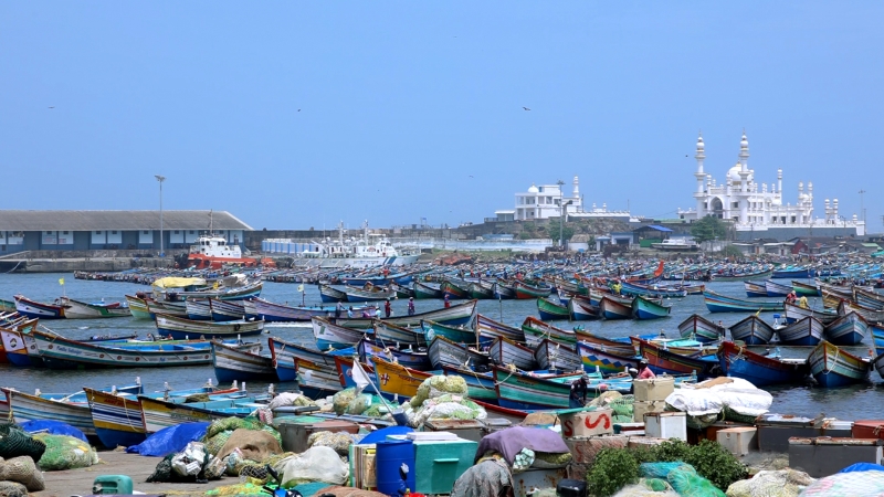
Small motorised boats docked in Vizhinjam harbour, Thiruvananthapuram. Often fishing is restricted during the monsoon. (Stills from the upcoming documentary Crashing Waves by Vincy Lopez)
Scientists have attributed this storm trend to changes in heat, temperature, and energy relationships between the lower atmosphere and upper ocean due to climate change.
The study that Mohapatra mentioned highlighted a rise in mid-tropospheric humidity over the Eastern Arabian Sea, especially during October–December.
The troposphere is the lowest layer of the atmosphere where weather happens.
Besides, changes in ocean temperature extend relatively stable, warmer layers within the deep ocean, thereby favouring cyclones.
It is not only sea surface temperature that drives cyclones but also the volume of warm ocean water. The heat content from the sea surface to the depth of 26 degrees C isotherm — an imaginary line connecting points with the same temperature — at 50–100 metres of ocean depth makes cyclones more intense.
While the ocean subsurface warming in the Eastern Arabian Sea spawns and revs up cyclones during March–June, mid-tropospheric changes lead to several cyclones within a short period during the October–December period, as the above study showed.
These changes translate to a new normal of more intense storms, extreme rains and frequent rough sea events. That means coastal communities on the map’s margins need better access to detailed, localised, impact-based weather services to stay safe. That is a global concern.
The Word Meteorological Organisation (WMO) notes that an effective impact-based forecasting and warning service is built on knowledge of the hazard combined effectively with an understanding of vulnerability and exposure relating to all sections of society.
Even with their considerable forecasting and warning expertise, national weather services may not be familiar with aspects of vulnerability and exposure, nor with disaster management. So, WMO calls for close collaboration amongst institutions and communities. The mantra: Talk to the people.
In changing, extreme and often uncertain weather, people have a right to stay safe and still pursue their livelihoods. Adequate early warnings are increasingly seen as a human right.
