Published Jun 12, 2023 | 3:54 PM ⚊ Updated Jun 12, 2023 | 3:54 PM

 (1)")
Clouds over South India as of 12 June. (IMD)

True to their literal meaning, the hills and mounts of the Nilgiris look blue beyond the morning mist, rainclouds playing touch and go.
The sight is magical, but this tantalising touch of the rain gods up in the hills is not enough to make farmers downhill happy.
Farmers of Wayanad — a portmanteau of two words Wayal and Nadu, literally meaning the land of rice paddies — say inadequate rains make it difficult for them to prepare their fields for the next round of sowing, and it could potentially affect the crop. The monsoon started late this year, on 8 June, with a low pick-up.
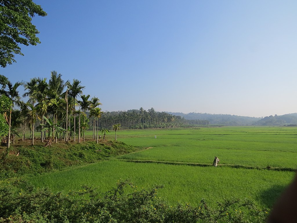
Paddy fields in Wayanad. (Creative Commons)
Usually, a monsoon break denotes a gap after a spell of good rains. The joke amongst rain-watchers in Kerala is that “before starting how can you apply the break?”.
More seriously, scientists say monsoon winds still lack momentum and they do not blow far into the land. This is seen as an effect of Cyclone Biparjoy which has affected monsoon wind patterns.
Meanwhile, Extremely Severe Cyclonic Storm Biparjoy is slowly moving northward, and it was located 320 km southwest of Porbandar in Gujarat, and 440 km south of Jakhau Port in Gujarat on Monday, 12 June.
India Meteorological Department (IMD) has predicted landfall near Jakhau Port on 15 June with a cyclone alert for Saurashtra and Kutch coasts with 125–135 kmph wind gusting to 150 kmph and storm surges.
In general, cyclones close to this time delay the monsoon onset and progress, by affecting wind flow and taking away clouds, studies by local scientists show.
As these studies show, it might take another week or two to re-establish rains as usual.
Radar images at the Advanced Centre for Atmospheric Radar Research, Cochin University of Science and Technology (CUSAT) show that some of the clouds hurled by the cyclonic system hovered over coastal Kerala and gave showers over the past few days.

Cyclone Biparjoy in the Arabian Sea, as seen from the satellite. (India Meteorological Department)
The storm system can also bring rain, though briefly, and the line where the rains start has progressed rather quickly.
The northern limit of the monsoon has touched the Goa–Maharashtra border according to IMD’s map updated on 11 June.
With a normal onset on 1 June, it takes about 10 days for the monsoon rains to reach this point, but it took only three days after onset on 8 June.
“It is mostly influenced by Cyclone Biparjoy,” said Abhilash Sukumarapillai, director of ACARR said in a discussion forum on Sunday.
“Clouds aligned along the coast are producing light to moderate spells in the morning hours, and thundershowers at isolated places overland… These clouds are the reason for local wind gusts and sudden downbursts.”
In Wayanad, where they produce dozens of indigenous rice varieties, the forecast for the coming three days remains: “Generally cloudy sky with a few spells of rain or thundershowers…” The rains are expected to gain momentum later.
The autumn crop (Kharif) is traditionally sown in Wayanad during the summer rains by July, but land preparation has to start by mid-June.

Workers in paddy fields during monsoon.
“The rains are delayed,” said Joshy Paul, a local farmer working with Swayam Shikshan Prayog, an NGO promoting climate-smart farming, adding, “It has been like this since 2018.”
He explains that rains have to flood the fields to make them ready for ploughing.
The farmers lost sown seeds in the floods of 2018 and 2019; many of them now sow in August, after the flood season with a later than usual harvest, Paul told South First.
Wayanad suffered extreme rain and floods in 2018 and 2019. It is one of the districts where the government is prepared for floods this time as well.
“Given most of the rice fields here are dependent on water from springs or streams, a delayed monsoon definitely means a delay in beginning land preparation work,” said Rajesh Krishnan CEO of Thirunelly Agri Producer Company Ltd (TAPCO) works with local rice farmers.
“Going by the experience of the previous years, when the rains finally start there could be intense short spells or rain that leads to soil erosion and washing away of the nutrient-rich topsoil.”
The usual pattern of rain in Wayanad used to be continuous rain since early June with increased intensity by mid-July, according to local farmers.
They prefer to plough wet, muddy fields. Flooding the fields for the first two rounds of ploughing helps in mixing and decomposing weeds as green manure — an essential ingredient for a good crop.
“Delayed monsoon could mean that the gap between the initial ploughing and planting will reduce, leading to fewer nutrients, more weeds and poorer crops,” Krishnan said.
“We expect floods this year as well,” Joshy said, in a matter-of-fact tone. Despite the huge damage they cause, the flood waters could also bring nutrient soil and boost production, he shared the hope of the local farmers.
