Published Oct 03, 2023 | 7:30 AM ⚊ Updated Oct 03, 2023 | 7:30 AM


IMD forecasts a normal or above normal northeast monsoon. (iStock)

While the Southwest Monsoon effected a late — and continuing — rally to narrow the overall rain deficit somewhat, forecasters seem gung ho about a good Northeast Monsoon, influenced by large-scale weather phenomena in the Pacific and the Indian Ocean.
India Meteorological Department (IMD) has forecast a normal or above-normal Northeast Monsoon, a lifeline in parts of South India.
The major share of the annual rainfall over India comes during the Southwest Monsoon (June–September), while parts of the southeast peninsula remain rain deficient. That is till the Northeast Monsoon (October–December, and also called the retreating monsoon) brings rain here.
In the southern peninsular region of six Meteorological Subdivisions — Coastal Andhra Pradesh, Rayalaseema, South Interior Karnataka, Coastal Karnataka, Tamil Nadu, and Kerala — several places receive as much as half (17–49 percent) the rainfall during the Northeast Monsoon.
The country as a whole receives about a tenth (11 percent) of its annual rainfall from this.
Meanwhile, heavy rains continued in Kerala after the end of the summer monsoon season on 30 September.
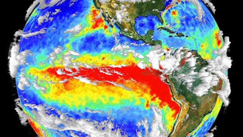
Combined 3-D cloud and surface temperature data in this image shot by the NASA Terra satellite, shows an earlier full-blown El Niño condition. The red area denotes warm water off the coast of western South America. Photo: NASA
“With El Niño and a positive Indian Ocean Dipole, there is scope for a normal or above-normal NE monsoon this year,” tweeted Madhavan Nair Rajeevan, monsoon expert at the National Centre for Earth Science Studies, Thiruvananthapuram.
El Niño denotes a large-scale ocean-atmosphere climate phenomenon linked to periodic warming in sea-surface temperatures across the central and east-central equatorial Pacific. Historically it has been associated with droughts in India. However, it is known to favour a good Northeast Monsoon.
Such a causal connection or correlation between long-distance meteorological phenomena is called teleconnection.
Another teleconnection involves the Indian Ocean Dipole (IOD), denoting temperature differences between the western and eastern sides of the Indian Ocean. During a positive phase, warm waters are pushed to the Western Indian Ocean, bringing rains to Africa and elsewhere.
This pattern is reversed during the negative phase of the IOD. The IOD phase starts in May–June, peaking in August–October and then rapidly decays. The positive phase IOD favours normal or above normal Northeast Monsoon rainfall over southern peninsular India.
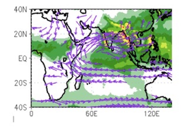
Southwestern monsoon winds. (Supplied)
The Indian summer monsoon ended with a six percent deficit amidst high variations across India. The overall rain deficit in the southern peninsula was limited to eight percent, with good rains towards the end of the season.
Out of the total 36 Meteorological Subdivisions, seven recorded deficient rainfall, including South Interior Karnataka and Kerala, the IMD noted.
The IMD map of rainfall over homogenous regions negative departure for much of the season, except late July and early August.
“Rainfall over the country as a whole during monsoon season (June-September), 2023, was 94 percent of its long period average (LPA),” IMD said in a media release marking the end of monsoon on 30 September.
Seasonal rainfalls over Northwest India, Central India, South Peninsula and Northeast (NE) India were 101 percent, 100 percent, 92 percent, and 82 percent of the respective LPAs, the national forecaster said.
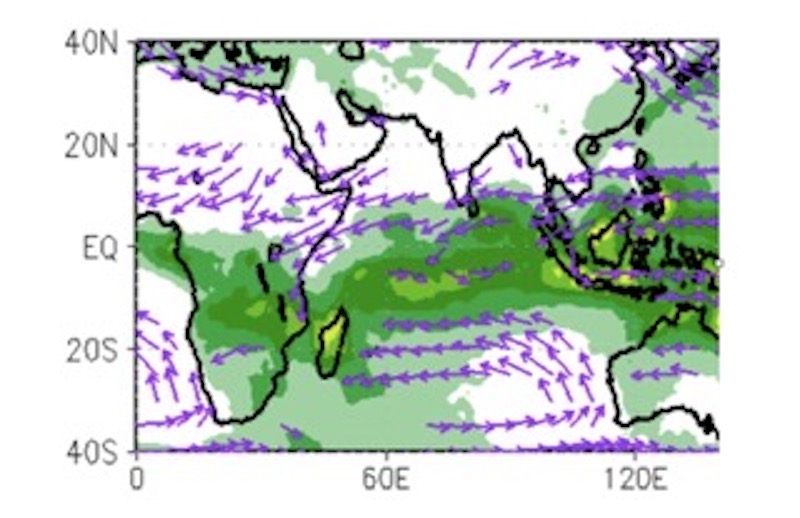
Northeastern Monsoon winds. (Supplied)
The Northeast Monsoon is associated with northeast trade winds. During this season, low-pressure systems and cyclonic storms occasionally form over the south Bay of Bengal with modulation during El Niño years. The season is also marked by severe storms over the Arabian Sea of late.
The Northeast Monsoon rainfall varies annually twice as much as the Southwest Monsoon rainfall with extreme deficit and excess rainfall years.
“The forecasts for the rainfall over the country during the season as a whole could be predicted well as the realised rainfall is 94 percentof LPA against the forecast of 96 percent ± 4 percent,” IMD said.
The monsoon reached Kerala seven days after the normal onset date, on 8 June. As the monsoon advanced, scientists attributed the delay in its onset over Kerala to Typhoon Mawar over the Pacific.
The storm was temporarily stalling a weather phenomenon called Madden-Julian Oscillation from advancing to the Indian Ocean, scientists said.
Madden Julian Oscillation involves a large-scale envelope of cloud clusters and rain systems moving eastward along the equator in cycles of 30–60 days, influencing tropical cyclones and extreme weather.
MJO influences the Indian monsoon by increasing or reducing convection (vertical transport of heat and moisture as in a thunderstorm) in the atmosphere during the active and break periods, respectively.
“2023 (season) ended with 6% deficit rains,” Rajeevan said. “This monsoon will be known for its spatial and temporal variability.”
