

Published Oct 15, 2026 | 9:30 AM ⚊ Updated Oct 15, 2026 | 9:30 AM

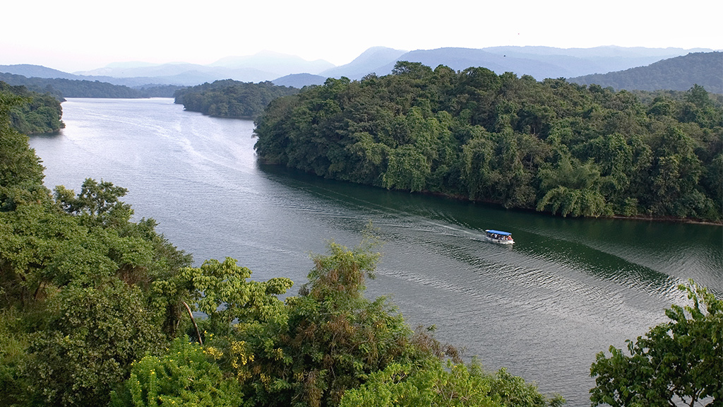
The 20 July earthquake in Peechi, measuring 2.6 on the Richter scale, was followed by a 1.2-magnitude aftershock two days later. (Kerala Tourism)

Synopsis: Nearly three months after tremors shook Peechi and Pananchery in Thrissur and left cracks in 35 houses, residents are still waiting for answers. No structural safety audits have been reported for the affected homes, and questions remain over the safety of the buildings, the condition of Peechi Dam and the need for a detailed scientific investigation. With authorities yet to establish the cause of the recurring rumblings and reported tremors, the episode has also revived concerns over whether reservoirs can trigger seismic activity in Keralam’s geologically fragile Western Ghats.
Almost three months after tremors rattled Peechi and Pananchery in Thrissur and cracked the walls of dozens of houses, no scientific explanation for the damage remains.
The 20 July earthquake, measuring 2.6 on the Richter scale, was followed by a 1.2-magnitude aftershock two days later, but whether the tremors caused the cracks remains unproven.
Of the 37 complaints received, damage has been confirmed in 35 houses.
With no structural safety assessment of the affected homes on record and reports of further tremors yet to be backed by seismic data, residents are still waiting for an answer to a basic question: what exactly happened beneath Peechi in July?
Also Read: Kerala needs disaster audits, not just disaster relief
A 2.6-magnitude earthquake struck the Peechi Reservoir area on 20 July, triggering tremors in Peechi and Pananchery and leaving cracks in several houses. An aftershock measuring 1.2 magnitude was recorded two days later, while residents continued to report rumbling sounds and minor tremors in the area.
According to data from the National Centre for Seismology (NCS), the 20 July earthquake had its epicentre near Peechi Reservoir, at latitude 10.547 and longitude 76.420, with a focal depth of around 10 km.
The 22 July aftershock was the only subsequent event for which an official magnitude was available. Although residents reported further tremors and micro-tremors, the NCS had no corresponding intensity records.
The recurring disturbances prompted district authorities to seek a scientific assessment of the phenomenon.
On 23 July, then District Collector Shikha Surendran visited houses where cracks had appeared following reports of underground rumbling and unusual sounds.
The Collector said she had submitted a request to the government for compensation for the damaged houses. A letter was also sent to the State Disaster Management Authority seeking a detailed study and the installation of additional seismographs to monitor seismic activity in the area.
Panchayat and village authorities were directed to distribute leaflets informing residents about precautions to be taken in the event of aftershocks.
The issue resurfaced at a District Disaster Management Authority meeting chaired by the Collector on 29 July. A team of geologists was directed to revisit the affected localities and conduct a detailed inspection of the cracks in houses.
The repeated tremors and damage to houses have raised concerns among residents, with district authorities seeking a closer scientific examination of the activity around Peechi.
Available seismic data confirms the two recorded events in July, but the cause of the recurring sounds and reported micro-tremors remains unestablished.
Also Read: Almost 50-year-old story of a dam Kerala wants to build —TN doesn’t want to hear
Thirty-five houses in the Peechi region have sustained damage, including wall cracks, following recurring tremors, but none has undergone a structural safety assessment.

Thirty-five houses in the Peechi region have sustained damage, including wall cracks, following recurring tremors
Of the 37 complaints received about cracks and other damage to houses, the Tahsildar has confirmed damage in 35 cases.
A geologist has also been asked to examine whether the tremors caused the damage.
However, the government has not conducted structural assessments to determine whether the affected houses remain safe for occupation.
The latest disclosure has raised concerns about the authorities’ preparedness as tremors continue to be reported in the region around Peechi Dam.
No detailed technical assessment report is available confirming that experts inspected the dam, its associated structures, the reservoir area, and surrounding localities after the tremors.
On seismic monitoring, the government said steps were under way to integrate the existing seismic observatory with the National Centre for Earth Science Studies (NCESS) National Seismological Network.
The move is intended to strengthen seismic monitoring in the area.
However, authorities concerned have yet to decide whether to launch a comprehensive scientific study into the geological and geophysical causes of the recurring tremors, the area’s seismic vulnerability, or the risks of future events.
The government has also not reported any structural safety assessment of the affected houses or outlined specific safety guidelines for residents.
On compensation, the District Collector has initiated steps to provide financial assistance to owners of houses damaged by the tremors under the existing Disaster Response Fund norms.
However, the authorities have yet to clarify how many applications were received, how many beneficiaries were approved, or the total amount sanctioned.
With 35 houses reported damaged, questions remain over the safety of the affected buildings, the structural condition of Peechi Dam and the need for a comprehensive, long-term plan to address seismic risks in the region.
At the same time, residents say that compensation alone will not settle the matter.
They said they need an explanation of what happened beneath Peechi, an assessment of the damage to their homes and clarity on whether the area faces any continuing risk.
Until they answer those questions, the cracks in the walls will remain a reminder of an unsettling episode whose cause is still unknown.
“We need to know whether our houses are safe. The cracks are there, but nobody has clearly explained what caused them. We cannot keep waiting without knowing if it is safe to live here,” said a resident of Jandamukku, one of the affected areas.
At the same time, another resident of Pallikunnu, whose house was damaged by the tremors, said that even if it takes time to establish the cause of the cracks, the authorities should first tell us whether the houses are safe.
“We need a proper inspection, not just a count of the damaged buildings,” said the resident.
Also Read: Hidden cost of Kerala’s disaster vulnerability
The presence of large dams does not automatically make an area prone to earthquakes. Still, the combination of reservoir pressure and underlying geological weaknesses warrants attention, particularly in Keralam’s Western Ghats, experts have warned.
A Water Resources Department official said seismic activity near dams could not be attributed solely to the volume of water stored in reservoirs.
The official said the region’s geological and tectonic conditions were equally important, pointing to instances of reservoir-induced seismicity reported from different parts of the world.
In India, the Koyna-Warna region of Maharashtra is a prominent example of seismic activity associated with a major reservoir. The Koyna earthquake of 1967, which killed around 180 people, remains one of the most significant cases cited in studies on reservoir-induced earthquakes.
Research has also raised questions about the potential impact of extreme rainfall and flooding on seismic activity in Keralam.
A study published after the state experienced two consecutive years of severe monsoon floods suggested that the huge influx of water could alter stresses within the underlying rocks and potentially increase the risk of seismic activity in susceptible areas.
According to Ramasamy Somasundaram, Professor of Eminence at Bharathidasan University in Tiruchirappalli and lead author of the study, reservoirs with water columns exceeding 100 metres could be particularly relevant to the phenomenon.
The weight of stored water increases stress on the Earth’s crust, while water seeping into underlying rocks can alter the effective stress along existing fractures and faults. Under certain geological conditions, these changes can trigger earthquakes.
Keralam’s geographical setting adds to the concern.
The state has more than 43 dams and reservoirs, many situated in the deep valleys of the Western Ghats, a region marked by folded, fractured and faulted rock formations.
The study drew attention to geological lineaments — linear features associated with faults and fractures — identified through satellite imagery, including data from India’s Resourcesat mission and NASA’s Shuttle Radar Topography Mission. Repeated deformation along some of these features points to geological weaknesses that could influence the region’s response to changes in subsurface pressure.
However, the findings do not establish that Keralam’s dams have triggered earthquakes or that reservoir storage will necessarily lead to seismic events. The risk depends on local geological conditions, reservoir characteristics, and pressure changes within the underlying rock formations.
(Edited by Majnu Babu),



