

Published Oct 24, 2026 | 4:55 PM ⚊ Updated Oct 24, 2026 | 4:55 PM

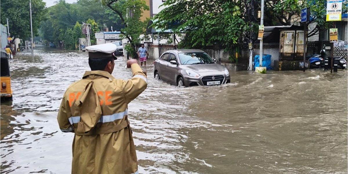
Water logging in Chennai following rain. (File Photo)

The India Meteorological Department (IMD) has warned of heavy to very heavy rainfall across several districts of Tamil Nadu as a well-marked low-pressure area over the east-central and adjoining southeast Bay of Bengal is expected to intensify into a cyclonic storm by October 26.
According to the IMD’s special bulletin issued at 1 pm on Saturday, the system is likely to intensify into a depression on October 24, strengthen into a deep depression on October 25 and develop into a cyclonic storm over the west-central Bay of Bengal by October 26. It is then expected to move west-northwestwards and reach the west-central Bay of Bengal near the Andhra Pradesh coast around the morning of October 28.
The IMD has issued rainfall warnings for several districts in Tamil Nadu over the coming days.
On Saturday, October 24, extremely heavy rainfall accompanied by thunderstorms and winds of 40–50 kmph is forecast at isolated places in the Nilgiris district. Heavy to very heavy rainfall is likely in Villupuram, Cuddalore, Mayiladuthurai, Nagapattinam, Tiruvarur, Thanjavur, Kallakurichi and Tiruvannamalai districts, as well as Coimbatore, Puducherry and Karaikal.
Heavy rainfall is also forecast in Chennai, Tiruvallur, Chengalpattu, Kancheepuram, Pudukkottai, Vellore, Ranipet, Tirupattur, Ariyalur, Perambalur, Tiruchirappalli, Karur, Namakkal, Salem, Dharmapuri, Krishnagiri, Erode, Tiruppur, Theni, Dindigul, Madurai, Sivaganga, Ramanathapuram and Kanniyakumari districts. Moderate rainfall is likely in Virudhunagar, Tenkasi, Thoothukudi and Tirunelveli.
For Sunday, October 25, isolated extremely heavy rainfall is forecast in Theni, Dindigul and Madurai districts. Heavy to very heavy rainfall is likely in Cuddalore, Mayiladuthurai, Nagapattinam, Tiruvarur, Thanjavur, Pudukkottai, Ariyalur, Perambalur, Tiruchirappalli, Karur, the Nilgiris, Coimbatore, Tiruppur and Sivaganga districts, as well as Karaikal.
Heavy rainfall is also expected in parts of Tiruvallur, Chennai, Chengalpattu, Kancheepuram, Villupuram, Kallakurichi, Vellore, Ranipet, Tirupattur, Tiruvannamalai, Namakkal, Salem, Dharmapuri, Krishnagiri, Erode, Virudhunagar and Kanniyakumari, and in Puducherry.
On October 26, isolated heavy to very heavy rainfall is forecast in Sivaganga, Ramanathapuram and Pudukkottai districts. Heavy rainfall is likely in parts of the Nilgiris, Coimbatore, Theni, Madurai, Dindigul, Virudhunagar, Tenkasi, Tirunelveli, Kanniyakumari and Thoothukudi districts.
The weather system is expected to bring comparatively lighter rainfall to Tamil Nadu from October 27, with isolated heavy rain forecast in Ramanathapuram. Light to moderate rainfall may occur in parts of southern Tamil Nadu on October 28, while largely dry conditions are forecast elsewhere in the state, Puducherry and Karaikal.
Tamil Nadu experienced an active northeast monsoon over the past 24 hours, with light rainfall reported at most places across the state and in Puducherry and Karaikal.
The highest rainfall recorded was 250 mm at Barliyar in the Nilgiris district. Other significant rainfall totals included 200 mm at Kil Kotagiri Estate, 170 mm at Coonoor AWS and Coonoor PTO, 160 mm at Alagarai Estate and 150 mm at Mettupalayam in Coimbatore district.
For Chennai, the IMD has forecast partly cloudy skies on Saturday, with light to moderate rain accompanied by thunderstorms possible in some areas. The maximum temperature is expected to be around 30–31 degrees Celsius and the minimum around 24–25 degrees Celsius.
PJ Interpretation of Weather Charts for the Common Man – 24.10.2026
================
1.North / North Interior Tamil Nadu
—————————–
Widespread rainfall is expected across the northern interior districts, with heavy to very heavy rainfall possible at isolated locations. Districts to watch: Tirupattur, Tiruvannamalai, Krishnagiri, Dharmapuri, Salem, Kallakurichi, Villupuram and Cuddalore.Watch – Hill Areas: Yercaud, 3. Kolli Hills, Kalrayan Hills and Jawadhu Hills could receive intense rainfall.
2. Cauvery Delta and Adjoining Districts
———————–
Southerly winds are expected to bring moderate to heavy rainfall across parts of the Cauvery Delta and adjoining districts. Districts to watch: Thanjavur, Tiruvarur, Nagapattinam, Mayiladuthurai, Tiruchirappalli, Ariyalur, Perambalur and Pudukkottai.3. West Tamil Nadu and Hill Districts
————–
Districts to watch: Nilgiris, Coimbatore, Tiruppur, Erode, Karur and Namakkal. The Nilgiris and adjoining Western Ghats terrain stand out for the potential for locally heavier rainfall. Coimbatore, Tiruppur, Dindigul and Erode may also receive showers, with rainfall intensity varying considerably from place to place.Coonoor: Hill slopes and vulnerable terrain in the Nilgiris could experience intense spells and landslides.
4. South Tamil Nadu – Kanyakumari and Nellai ghat areas
————————
Rain is possible around Kanyakumari and nearby southern areas. Some places in Kumari could receive heavy rain today.5. KTCC (Chennai)
——————
Rains are expected to pick up later at night to morning. Tomorrow looks Semma! and best day for rains Let’s see how it pans out.Overall: North Interior Tamil Nadu and the Coonoor Nilgiris belt deserve close attention, while moderate to heavy spells are possible across parts of the Cauvery Delta.
— Tamil Nadu Weatherman (@praddy06) October 24, 2026
On Sunday, the city is likely to remain partly cloudy, with moderate to heavy rain accompanied by thunderstorms possible in isolated areas. The maximum temperature is forecast to be around 31–32 degrees Celsius.
The IMD’s current forecast places the system over the west-central Bay of Bengal near the Andhra Pradesh coast around October 28. The bulletin has issued a pre-cyclone watch for the Andhra Pradesh and adjoining south Odisha coasts.
The IMD has forecast winds reaching 50–60 kmph, gusting to 70 kmph, over parts of the Bay of Bengal on October 25. Gale-force winds of 70–80 kmph, gusting to 90 kmph, are likely over the west-central and adjoining east-central Bay of Bengal by the morning of October 26, with further intensification possible through October 28.
Fishermen have been advised not to venture into the east-central and adjoining southeast Bay of Bengal and waters around the Andaman Islands from the evening of October 24 to October 26. Restrictions are also advised for the west-central and adjoining northwest and southwest Bay of Bengal from October 26 to 28, and along and off the Andhra Pradesh–Odisha coasts from October 27.
Also Read:
(Edited by R Rajesh Kumar.)



