A forest department signboard was pulled off and smeared with black paint by a group of residents of Angel Valley village,

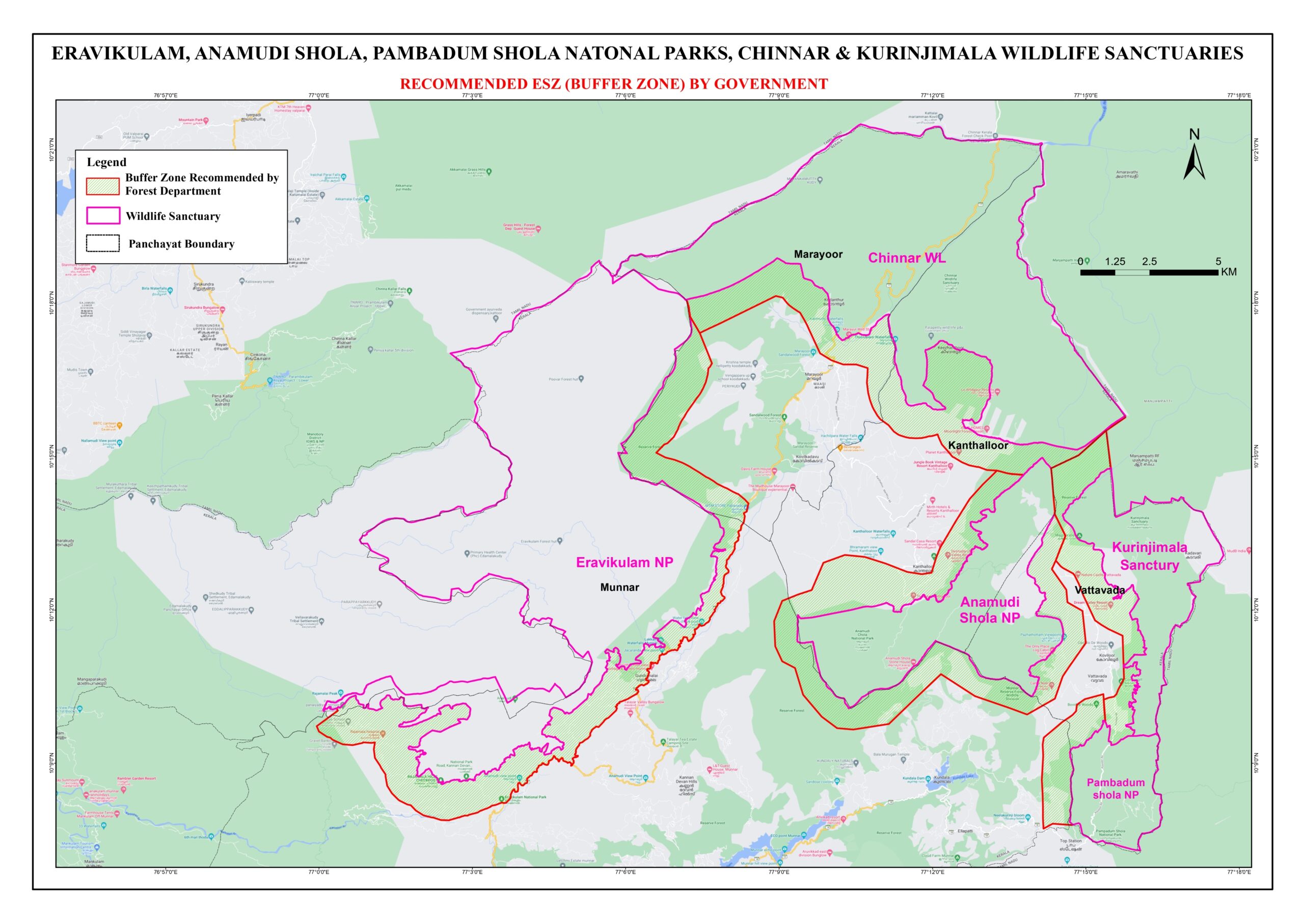
One of the maps showing the buffer zone. (Supplied)
A Forest Department signboard was pulled down and smeared with black paint by a group of residents of Angel Valley village in the Kottayam district of Kerala on Friday, 23 December, a day after the LDF government published the eco-sensitive zone (ESZ) maps and buffer zone reports on its official website.
The scene was somewhat similar to the anti-SilverLine protests seen several months back when people pulled out the cylindrical concrete survey stones from their properties and threw them away.
In Angel Valley, irate locals told TV channels that they were given lands there several decades ago by the state government and after they built a life there, it was all being jeopardised by showing it as forest area in the ESZ maps.
Several women and men, who were leading the protest, said, “We now have nothing to lose. We will not hesitate to kill or die for our lands.”
After pulling out the signpost which showed the way to the Pampa Forest Range office, hundreds of locals marched to the forest office chanting slogans that they will not give up their lands to anyone.
At the office, they dumped the signpost on the ground and smeared it with black paint.
Residents of the area said their parents and grandparents were given lands in Angel Valley by the state government several decades ago and through sheer hard work, they built homes and created a livelihood for themselves.
“Now, they are saying we are living inside the forest area. How is that fair? There are several thousand families living here. We cannot leave this place now,” they said.
“They are making a fool of us. They said we can send objections. Hundreds sent applications to the government indicating their objections. But now they have published this map saying it is a forest area,” another resident of the area said to the media.
According to the government website, these were the ESZ maps of various protected areas in the state submitted by the Forest and Wildlife Department to the Centre.
ESZs, demarcated near 22 protected forests including sanctuaries and national parks in the state, could be seen in these maps shown in the website.
ESZs, inhabited areas and other constructions were marked under different shades and people can submit their complaints to the authorities concerned after verifying the maps of their respective areas and the buffer zone report.
According to official sources, the report, published along with the map, was a preliminary one prepared based on the satellite images of establishments, houses and other constructions and various activities which fall within the one km radius of protected forests in the southern state.
The buffer zone report, prepared during 2020-21, was already sent to the Centre.
To allay people’s apprehensions, state Forest Minister A K Saseendran on Thursday had said the strong stand of the Left government is to exclude the inhabited areas from the ESZs.
The field survey in the respective regions would be conducted in a time-bound manner, state Revenue Minister K Rajan said.
In June, the Supreme Court had directed that a buffer zone of one kilometre be maintained around forests and sanctuaries across the country. Challenging this, both the Centre and the Kerala government had filed review pleas in the apex court.
(Disclaimer: Only the headline, subheads, and intro of this report along with the photos may have been reworked by South First. The rest of the content is from a syndicated feed)

May 18, 2024

May 18, 2024

May 18, 2024

May 18, 2024

May 18, 2024

May 17, 2024