

Published Aug 25, 2026 | 4:45 PM ⚊ Updated Aug 25, 2026 | 4:45 PM

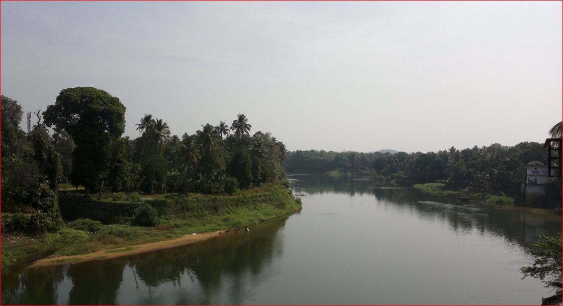
Muvattupuzha has an economic identity different from the Kochi-centred urban economy of western Ernakulam.

Synopsis: Muvattupuzha’s four-decade-old district dream dates back to 1982, when then Chief Minister K Karunakaran backed the idea and appointed the Babu Paul Commission to examine its feasibility. Kasaragod became Keralam’s 14th and last district in 1984, but Muvattupuzha’s demand remained unfulfilled. Now Chief Minister V D Satheesan’s announcement of a new commission has revived the proposal and could reopen Keralam’s district map for the first time in over 40 years.
A sweet-tart aroma fills the nostrils as you approach Vazhakulam. It is the smell of ripe pineapple heaped like little hills by the road, waiting to be loaded onto lorries that cross Keralam’s borders for far-away destinations.
Away from the noise and density of Kochi, Vazhakulam—which goes by the sobriquet, the Pineapple City—in Muvattupuzha town sits at a different rhythm: one shaped by farms, traders, rubber plantations, pineapple markets and the roads that carry produce from the eastern highlands to the rest of the country.
Muvattupuzha is now back at the centre of Keralam’s district map for a different reason.
Chief Minister VD Satheesan said the government will seriously examine the long-standing demand to make Muvattupuzha a separate district and will constitute a commission to look into creating new districts.
His statement has revived a question that has been hanging over central Keralam for more than four decades: could Muvattupuzha finally become Keralam’s 15th district?
Satheesan has announced an examination of the demand, not the creation of a district. But the significance of his statement is that the government is talking about a commission to examine district reorganisation—potentially opening the door to demands from several parts of Keralam.
Also Read: Woman foils midnight, trucker and stranger help save her
Muvattupuzha’s case is not simply about administrative boundaries. The town grew at the meeting point of three rivers and historically functioned as a trading centre connecting the plains with the eastern highlands.
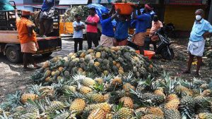
Vazhakulam market
It remains an important link between Ernakulam’s urban economy and the agricultural economy stretching towards Idukki.
Its most distinctive economic identity comes from Vazhakulam.
Vazhakulam pineapple has been commercially cultivated in the region for more than half a century. The fruit received a Geographical Indication (GI) registration in 2009 and Vazhakulam is recognised by the Keralam government’s GI portal as the centre of Keralam’s pineapple trade, with about 80% of the state’s pineapple harvest moving through the market.
The pineapple is not merely a crop here. It is an ecosystem of farmers, traders, transporters, wholesalers, processors and exporters.
The Mauritius variety associated with Vazhakulam is known for its aroma, sweetness and crisp, golden flesh—the registered specifications put its typical sugar level at 14–16° Brix.
The region is also a major rubber-growing belt and a gateway of the high ranges in the east.
That combination gives Muvattupuzha an economic identity different from the Kochi-centred urban economy of western Ernakulam.
That is one of the central arguments made by supporters of a separate district- Muvattupuzha is neither quite Kochi’s urban hinterland nor an Idukki-like hill region. It occupies its own geographical and economic middle ground.
Also Read: Why little-known tourist spot Maravanthuruthu won big at World Travel Mart in London
This is where the district proposal becomes more complicated. Muvattupuzha municipality itself is relatively small.
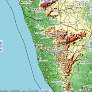
Muvattupuzha municipality itself is relatively small.
According to 2011 Census data compiled by Keralam’s Directorate of Economics and Statistics, the municipality covers only 13.18 sq km and had a population of 30,397.
But the proposed district would obviously extend far beyond the municipality.
The present Muvattupuzha taluk had a 2011 population of 3,36,224, accounting for about 10.24% of Ernakulam district’s population at the time.
Ernakulam as a whole had 32.82 lakh people in 2011.
What exactly would constitute the new district is still an open question.
One possible configuration discussed by supporters includes Muvattupuzha, Kothamangalam, Piravom and Pampakuda along with parts of Thodupuzha and other eastern areas. But this is precisely where the politics and geography become difficult.
Some areas have historically preferred staying with Ernakulam because of its industrial and commercial advantages. Perumbavoor and parts of Kunnathunad, for instance, have developed strong economic links with the Kochi-Ernakulam urban belt.
Similarly, as development projects expanded around places such as Piravom and the southern parts of Ernakulam, the appetite for joining a predominantly agricultural eastern district has not necessarily remained constant.
So the question is not merely whether Muvattupuzha should become a district.
It is also which part of Muvattupuzha?
Where would its boundaries run? Which panchayats would join it? Would Kothamangalam be included? What happens to Thodupuzha? Would parts of Idukki be brought into the proposed district? And would areas that have economically benefited from being part of Ernakulam actually want to leave?
Those questions could determine the proposal’s fate.
Also Read: Oily substance found floating on Kerala’s Malankara reservoir
The demand is more than 40 years old. In 1982, when Pathanamthitta district was created, then Chief Minister K Karunakaran said that if another district were to be created, it would be Muvattupuzha.
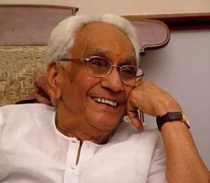
K Karunakaran
A commission headed by former Additional Chief Secretary Dr D Babu Paul was subsequently appointed to examine the possibility. The Babu Paul Commission submitted a detailed report supporting the feasibility of Muvattupuzha as a district.
But the proposal never became reality.
Then came Kasaragod.
Kasaragod was carved out of the undivided Kannur district and became Keralam’s 14th and last district on 24 May 1984. The official district history records that the new district initially comprised the Kasaragod and Hosdurg taluks.
And there the map stopped changing.
For more than four decades, Keralam has continued with 14 districts.
That is why Satheesan’s announcement is significant. It is the first time in decades that a Keralam Chief Minister has publicly reopened the question of creating new districts.
Also Read: Farmers turn undertakers as humans, animals die in illegal traps
The argument is fundamentally administrative. A district is the state’s principal administrative unit below the state level. Creating one means bringing government departments, revenue administration and public services closer to people.
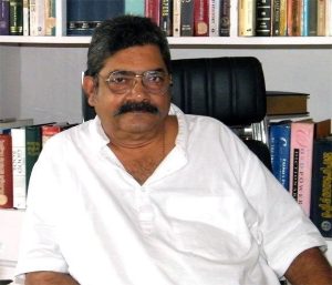
Dr D Babu Paul
Supporters argue Muvattupuzha already has many of the ingredients required for a district headquarters: established hospitals and educational institutions, commercial activity, road connectivity, agricultural markets and a sizeable population in its wider region.
It is also close to Cochin International Airport and lies on an important route towards Munnar and the eastern high ranges.
The town has another unusual advantage: its court infrastructure is substantial, with its judicial complex often cited as one of the largest in the state outside the High Court.
But creating a district is expensive.
A new district headquarters would require administrative infrastructure and offices for many government departments. Land, buildings, staff, vehicles and other facilities would all have to be created or reorganised.
This is particularly important as Keralam faces financial constraints.
Also Read: When Periyar was tamed to change Kerala’s energy history
The biggest hurdle may actually be geography. Muvattupuzha sits close to the borders of Idukki, Kottayam and the rest of Ernakulam. Any new district would have to negotiate existing economic, political and social relationships.
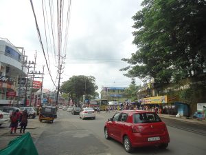
Muvattupuzha Town. (Ranjith Siji/Creative Commons)
Thodupuzha, for example, has its own long-standing association with Idukki. Parts of the eastern region have commercial links with Kochi, while others look towards the high ranges.
Questions also involve linguistic and geographical minorities, the Mullaperiyar region, and the practical consequences of changing administrative boundaries.
The boundaries proposed in the Babu Paul Commission’s era were designed for a very different Keralam. Four decades of population growth, urbanisation, new roads, changing economic centres and development projects mean that simply reproducing the 1982 map may not be possible.
This is where the proposed commission becomes important.
Satheesan has not said that the government will implement the old Muvattupuzha proposal. Instead, he has indicated that a commission will examine the creation and reorganisation of districts.
That could mean a much larger exercise.
Keralam’s 14-district structure looks different when compared with neighbouring states. Karnataka currently has 31 districts, while Tamil Nadu has 38.
Keralam, by contrast has remained at 14 since Kasaragod was created in 1984.
Also Read: Kasaragod, Idukki, Wayanad get special posting rules for officials
If the government opens the door to new districts, Muvattupuzha is unlikely to be the only claimant. The strongest political demand emerging alongside it is from Malabar, particularly for the bifurcation of Malappuram.
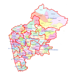
Assembly constituencies’ map, Malappuram
The numbers make the argument difficult to ignore.
Malappuram had a 2011 population of 41.13 lakh, compared with 32.82 lakh in Ernakulam, despite Malappuram covering about 3,554 sq km and Ernakulam about 3,063 sq km. Malappuram’s population density was about 1,157 people per sq km, against Ernakulam’s 1,072.
It has 16 Assembly constituencies and two Lok Sabha constituencies, and its seven taluks serve a population larger than that of several entire districts.
The demand for dividing Malappuram has existed for years, with the Indian Union Muslim League and other organisations arguing that population and administrative convenience should be central to any district reorganisation.
IUML state general secretary PMA Salam has now made the position clear, If Keralam is going to redraw its district map, population should be the principal criterion, not the interests of one particular region. He has argued that, on population grounds, Malappuram could even require division into three districts.
IUML leader and Tanur MLA PK Navas has also raised the issue, while organisations including Samastha and the Solidarity Youth Movement have backed the broader demand for population-based reorganisation.
There is another possible approach.
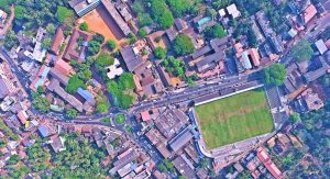
A 2016 aerial shot of Downhill, Malappuram. (Creative Commons)
Former minister and CPI(M) leader KT Jaleel has suggested that instead of simply creating new districts, Keralam could redistribute areas from heavily populated districts to neighbouring districts with smaller populations.
That raises the larger question now facing the government: is Keralam preparing to create one new district—Muvattupuzha or is it preparing to redraw its district map altogether?
Satheesan’s proposed commission could answer that.
For Muvattupuzha, however, the immediate significance is more personal. A place that has spent decades waiting for a district of its own has finally heard a Chief Minister say publicly that its demand will be seriously considered.
The pineapple lorries will still be leaving Vazhakulam every morning.
But for the first time since 1982, the road from Muvattupuzha to becoming a district does not look entirely closed.
(Edited by Majnu Babu).



