Published Dec 30, 2022 | 2:21 PM ⚊ Updated Sep 30, 2024 | 11:41 AM


The ₹1,000-crore resurvey aims at freeing all land owners of civil disputes and duplication of records, preventing land grabbing and encroachments. (Supplied)

Several states have evinced interest in the massive three-year land survey Andhra Pradesh launched two years ago. The land resurvey project, rolled out on 21 December, 2020, coinciding with Chief Minister YS Jagan Mohan Reddy’s 48th birthday, is an ambitious attempt to cleanse all land records.
“With an investment of ₹1,000 crore, the government will free all land owners of civil disputes and duplication of records, prevent land grabbing and encroachments,” Jagan said while launching the YSR Jagananna Saswatha Bhoo Hakku Mariyu Bhoo Raksha Padhakam at Jaggayyapeta in the Krishna district.
“The documents will be made tamper-proof also,” he added.
The chief minister said that land in Andhra Pradesh was last surveyed in 1930 during the British era. Jagan is trying to rewrite history by offering hassle-free registration and ownership of land.
So what is the resurvey all about and how will it help people?
The survey will cover 1.26 lakh sq km in the state. In three phases, it will survey every nook and corner of Andhra Pradesh, barring forest lands.
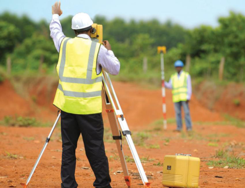
The Survey of India trained around 14,000 surveyors, who are part of the exercise. (Supplied)
The first phase surveyed 5,000 villages. The second phase will cover 6,500 villages and 5,500 villages will be covered in the third.
The survey will also cover cities and towns spread over 3,345.93 sq km, 10 lakh open plots and 40 lakh assessment lands and 2.26 crore acres belonging to 90 lakh Pattadar Passbook (Record of Rights) holders.
Permanent title deeds were handed over to 7,29,000 people in 2,000 villages spread over 4.3 lakh subdivisions in the first phase.
The first stage also witnessed two lakh mutations and 92,000 first-time entries and solutions to 19,000 land disputes.
“Arrangements have been made to complete the survey in 4,119 ward secretariats spread across 123 corporations and municipalities in urban areas by July 2023. The work is progressing at a brisk pace,” a senior official working on the project told South First.
The resurvey is being conducted using advanced technology: Drones, Continuously Operating Reference Stations (CORS) network, and Global Navigation Satellite System (GNSS) rovers.
The state government signed an MoU with Survey of India, the central engineering agency involved in mapping and surveying, in 2020.
The government also established a CORS network with 70 permanent base stations spread all over the state for operating 1,000 GNSS rovers.
The land owners will be provided physical receipts, besides a unique identification number and a QR code containing comprehensive details of the land.
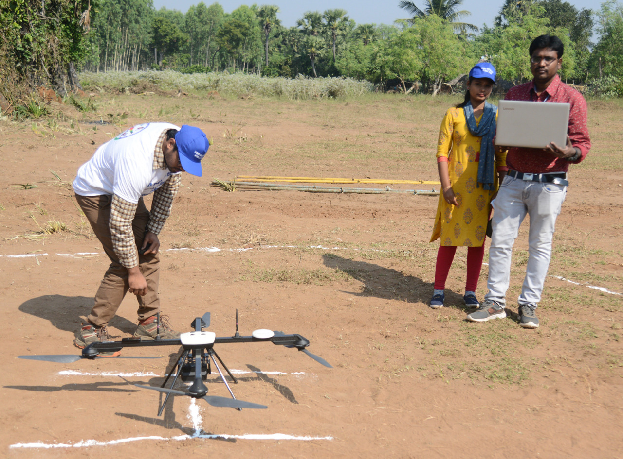
Each mandal will have one drone team, a data processing team and a resurvey team. (Supplied)
Each parcel of land will have Bhu Raksha boundary stones, which will be provided free of cost. In case of objections, there is also a provision for re-verification of land ownership rights under Section 12 of the AP Survey and Boundaries Act, 1923.
Digitised cadastral maps will be prepared after completing the survey. The map will have the details of the lands.
A digitised property and title registers and a register for recording complaints will be available at the village/ward secretariats.
To conduct the mammoth exercise, each Mandal will have one drone team, a data processing team and a resurvey team.
The Survey of India trained around 14,000 surveyors, who are part of the exercise.
The government also roped in the Centre for Tribal and Land Rights (CTLR) of the Hyderabad-based National Academy of Legal Studies and Research.
It is drafting, reviewing and preparing legal documents, besides imparting training, undertaking legal research, resolving land disputes and spreading legal awareness among the people.
The state government will be spending around ₹600 crore to plant boundary stone markers on the resurveyed landholdings.

AP is spending ₹81crore for drone surveys alone. (Supplied)
Of the estimated ₹987.4 crore required for the resurvey, ₹600 crore will be spent on procuring six crore marker stones at the local level.
Each stone will cost ₹100 a piece, including transportation. Stones in two sizes, one with a height of 60 cm, and another set with 90 cm are being procured.
Other expenditures will be ₹81 crore for the drone survey, ₹100 crore for buying CORS network’s field equipment and GNS rovers.
Another ₹21.21 crore will be spent on training the staff, ₹2.59 crore for logistics, and the recurring cost has been estimated to be ₹182.4 crore.
Revenue teams from several states have been visiting Andhra Pradesh to study the massive exercise.
“Resurvey project being conducted in Andhra Pradesh with the latest technology is a viable solution to decades-old survey problems. This is the first such project which is ideal for the entire country and beneficial to the average farmer,” said Niranjan Kumar Sudhanshu, Maharashtra Survey Settlement Commissioner and Director of Land Records.

The YSRCP government’s ambitious project has impressed several other states. (Supplied)
A team of 11 high-ranking officials from the Maharashtra Survey Department led by Sudhanshu toured several parts of Andhra Pradesh last December to study the land survey project being implemented in the state.
While inspecting the land survey work near Jaggayyapeta, the Survey Settlement and Land Records Commissioner of Andhra Pradesh, Sri Siddharth Jain briefed the Maharashtra team on various aspects of the land survey project being implemented here.
Sudhanshu said that it was not easy to designate an employee of the survey department, especially at the village level, to formulate a policy to complete the land registration process.
“Utilising the latest technology used at the international level to carry out the programme successfully without any shortcomings is commendable,” he added.
